
Reviewed · SELF-GUIDED TOURS
Point Reyes National Seashore Self Guided Driving Audio Tour
Point Reyes is at its best when you have time to stop, wander, and let the coast reveal itself. This self-guided audio tour turns a long drive into a narrated journey through beaches, shipwreck stories, wildlife overlooks, old ranch country, and the famous lighthouse at the tip of the peninsula.
I like the way the tour uses GPS to play stories as you drive, and I like the per-car price. One purchase covers up to four people, making it far cheaper than a private guide. The main drawback is that the app setup can be confusing, especially if you expect help at the visitor center.
I also like that the tour does not expire. You can pause for a meal, repeat a section, or return on another trip. Just download it over strong Wi-Fi or cellular service before you set out, since the route is remote and phone coverage may be limited.
Key points to know before you go
- More than 21 miles of narrated driving: The route includes over 53 audio stories and takes about two to three hours before adding hikes and detours.
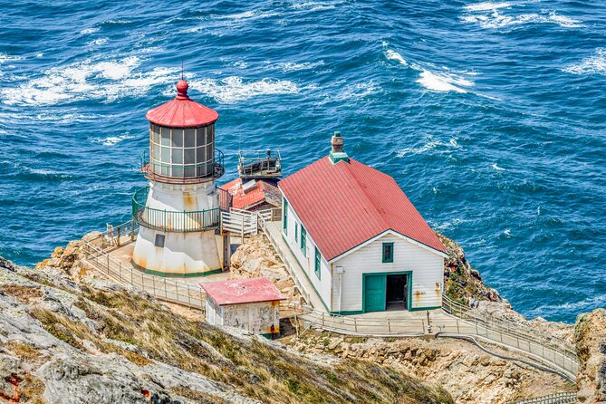
- The lighthouse is the grand finale: The drive ends at the Lighthouse Visitor Center, with parking advice built into the narration.
- Wildlife and beaches share the route: Look for elephant seals, sea lions, possible gray whales, broad beaches, and Drakes Bay views.
- The cypress tunnels have a real purpose: One leads to the historic KPH Radio station, while another points toward the unusual Leaning Tree.
- You control the pace: Pause the tour for photos, trails, snacks, and beach walks, then restart whenever you like.
- The app deserves preparation: Download the separate Action Tour Guide app, enter the password sent by email and text, and test the audio before leaving town.
A coastal drive with more than a lighthouse
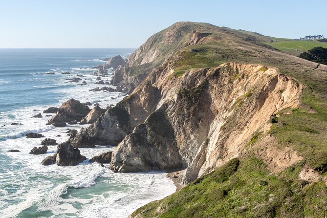
Many Point Reyes visits focus on the lighthouse, then turn into a quick out-and-back drive. This tour gives the whole peninsula a proper shape. You begin near Bear Valley Visitor Center, follow the road toward the coast, and finish at the Lighthouse Visitor Center after passing beaches, marshes, historic sites, and wildlife viewpoints.
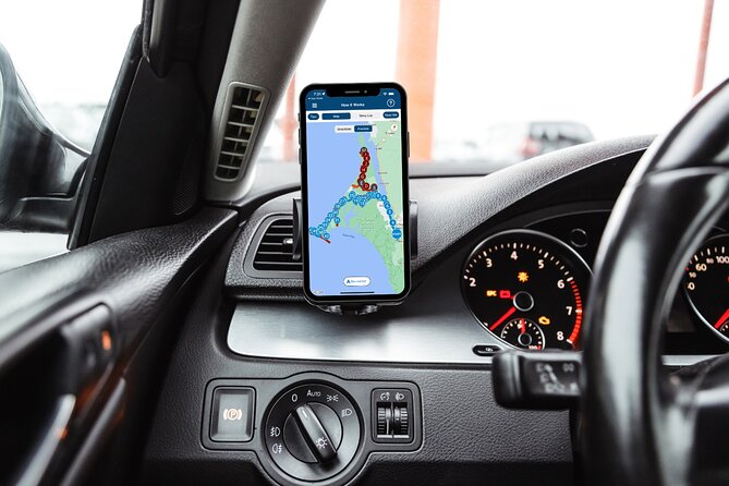
The audio is designed to play automatically as you reach each GPS point. You keep your eyes on the road, connect your phone to the car stereo by Bluetooth, USB, or AUX, and listen as the narrator explains what you are seeing. For walking stops, headphones can be useful.
The route has more than 53 stories, though not every one requires a long stop. The listed highlights generally allow about 10 minutes each, but that is only a rough guide. Tomales Point adds about 45 minutes of driving time, and the Drakes Estero walk takes about 2.5 miles round trip if you choose to hike.
You should think of the two to three hour estimate as driving and listening time, not a full sightseeing schedule. Add time for photos, trails, beach walks, and the lighthouse itself.
More self-guided audio walks in San Francisco:
- San Francisco: Alcatraz Ticket, Ferry, & Self-Guided App
★ 4.5 · 2,460 reviews - San Francisco: Alcatraz, Ferry & Audio Tour w/ Night Option
★ 4.4 · 617 reviews - Self-Guided Cable Car City Tour in San Francisco
★ 3.0 · 226 reviews
Starting at Bear Valley Visitor Center
The tour starts at 1 Bear Valley Visitor Center Access Road in Point Reyes Station. No guide meets you there. You simply open the Action Tour Guide app, select the correct version if more than one appears, and drive toward the starting point.
This distinction matters. The audio tour is not operated by the visitor center, and staff there may not know how to launch it. The first audio story should begin when you reach the proper GPS point. If nothing happens, check that location services are enabled, the tour was downloaded, and the phone has enough battery.
The setup instructions arrive by email and text after booking. Search for audio tour if the message is hard to find. You must download the tour while you have a strong connection. Once downloaded, it works offline, which is important on a long coastal route.
The app works best on an iPhone with iOS 15 or later, an Android device running version 9 or later, or an iPad or tablet with GPS and cellular capability. CarPlay is supported. Android Auto support is still being added.
Tomales Point and the open coast
The first major option is Tomales Point, a remote, windswept part of the peninsula known for wide beach views. The detour takes about 45 minutes round trip, before you add time for getting out, walking, and taking photographs.
This is a good early choice if you want a stronger sense of Point Reyes as open coast rather than a string of roadside stops. It is also the kind of detour that can disrupt a tight schedule. If you plan to reach the lighthouse at a particular time, keep an eye on the clock.
The audio gives you enough direction to make the decision from the car. You do not need to commit to every side trip. That flexibility is one of the tour’s better features.
Drakes Estero and a marshy inlet
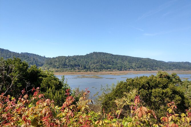
The route next reaches Drakes Estero, a marshy inlet with a 2.5 mile round-trip trail. The tour points out the trailhead and explains when to turn left if you want to walk.
The path crosses coastal grasslands and includes a scenic footbridge over the bay. This is a worthwhile choice if you want to stretch your legs and see a quieter side of the peninsula. It is not a quick photo stop, though. Plan on giving the walk real time, comfortable shoes, and attention to the weather.
If you are driving with children, older family members, or anyone who prefers a shorter outing, you can continue without hiking. The audio does not force the choice. It tells you where to turn and lets you decide.
More tours you can do at your own pace in San Francisco:
- Official Alcatraz Island Prison Tour with Free App Audio Packages
★ 4.5 · 337 reviews - San Francisco: Self-Guided Bike Rental
★ 4.7 · 161 reviews - Alcatraz Inside Access Ferry and Audio Tour with Night Option
★ 4.0 · 138 reviews - San Francisco: Self-Guided Electric Bike Rental
★ 4.9 · 82 reviews
The Cypress Tree Tunnel and KPH Radio station
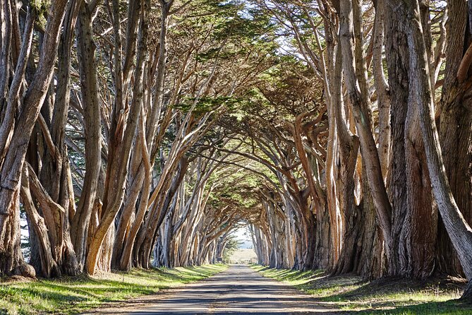
The Cypress Tree Tunnel is one of the route’s most memorable stops. Rows of cypress trees create a green passage leading toward the historic KPH Radio station.
The story here gives the trees a reason to exist. In 1929, the Radio Corporation of America built a radio station at Point Reyes because of its position along the coast. The trees were planted to make the station fit the setting rather than look like an unwanted industrial outpost.
That kind of detail is where an audio tour earns its keep. Without the narration, you might see a striking tunnel of trees and take a photo. With the story, you understand why the trees were planted and how the site once connected Point Reyes with ships at sea through Morse code.
The stop is easy to pair with a short walk and photographs. Bring patience if other cars are also stopping. The route is popular, and the tunnel is a narrow visual corridor rather than a large attraction with lots of room.
Point Reyes Beach and Drakes Beach
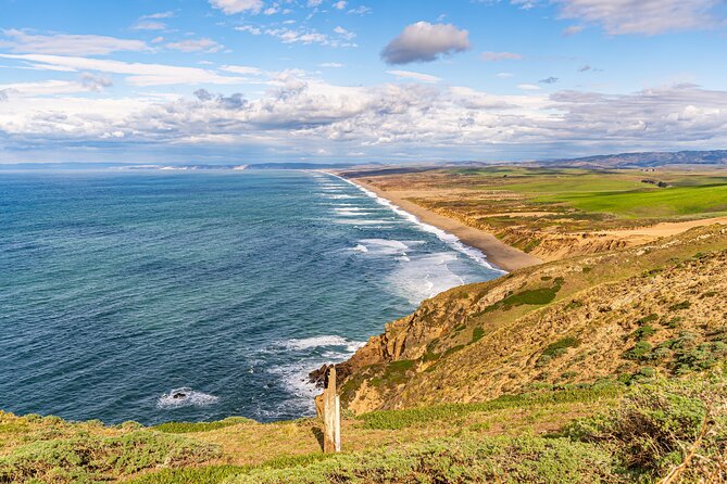
Point Reyes Beach gives you 11 miles of sand and open ocean. The audio also points out that gray whales are often seen from the beach in winter and spring.
That seasonal note is useful, but it should not be treated as a promise of a sighting. The value of the stop is the broad beach and ocean view, with whale watching as a possible bonus.
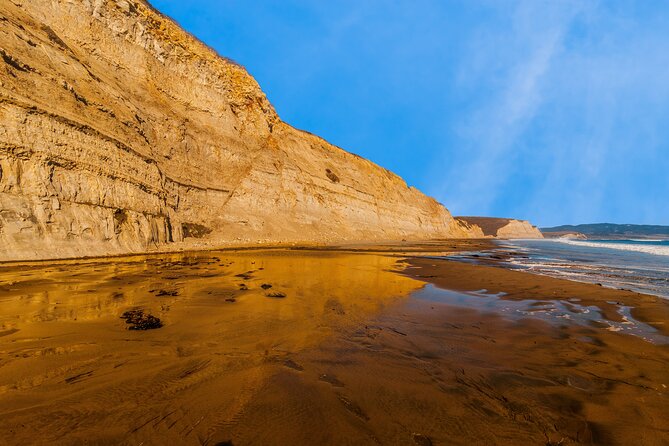
Drakes Beach feels different because it faces Drakes Bay. The water is more sheltered than the ocean-facing side, so the wind and surf may be less intense. White sandstone cliffs form the backdrop, giving the stop a more enclosed feel than Point Reyes Beach.
I would give yourself time at both if the day is not rushed. They show two different sides of the peninsula: one broad and exposed, the other calmer and framed by cliffs. The narration helps you understand that the change is not random. It comes from the direction each beach faces.
Chimney Rock and the lifesaving station
At the fork for Chimney Rock, you can turn toward a lifesaving station, an elephant seal overlook, and a trail leading to ocean views. This is one of the more history-heavy parts of the route.
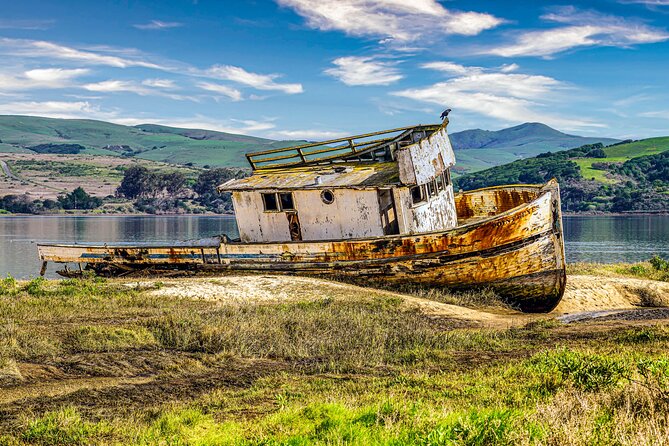
The first Point Reyes lifesaving station began operations in 1878. Its leader was known as the keeper, while the staff were called surfmen. They patrolled the beaches, watched for wrecks, and listened for voices through fog.
The station saved people from 14 major shipwrecks during the 37 years it operated. That fact gives the remote coast a human scale. You are not just looking at cliffs and water. You are seeing a place where poor visibility, strong surf, and isolated beaches created serious danger for ships.
The Chimney Rock area is also one of the better places to add a walk. The tour tells you where to turn, but you should expect conditions and access to depend on the park’s current rules and the day’s weather. Treat the stop as a chance to walk and look around, not a quick drive-by.
Elephant seals and sea lions
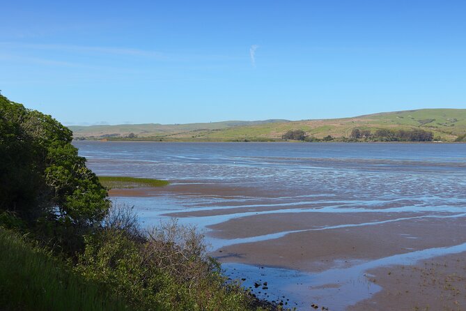
The wildlife stops add life to the drive. At the Elephant Seal Overlook, the narration traces the animals’ near disappearance after hunters used their blubber for oil. By 1892, only about 75 northern elephant seals remained along the entire North American coast.
Protection in Mexico and the United States during the 1920s allowed the population to recover. A breeding pair returned to Point Reyes in 1981, and the wider Pacific Coast population is now estimated at about 200,000.
The story works because it connects a quiet overlook with a much larger conservation lesson. You also get a useful reminder that wildlife populations can change sharply, for better or worse, depending on human choices.
The Sea Lion Overlook requires descending 54 steps to reach the coastal view. It can be a fine stop for animal watching, but remember that the return climb is part of the visit. The narration explains how to tell sea lions from seals: sea lions have ear flaps and can fold their rear flippers under themselves to move upright on land.
Males can reach about eight feet, females about six feet. During the May to August breeding season, males defend territory, call, bark, and fight while fasting on stored blubber. Females have a 12-month gestation period and usually give birth in June or July.
These details make the overlook more than a quick animal count. Still, wildlife is unpredictable. The audio describes what the site is known for, but it cannot guarantee that animals will be visible on your visit.
Reaching the Point Reyes Lighthouse
The route ends near the South Beach Overlook and the Point Reyes Lighthouse. This is the only parking lot for the lighthouse, so the tour sensibly advises you to park there rather than keep driving around.
Street parking may be available when the lot fills, but the area can become congested on weekends. Arrive with enough time to park and walk instead of assuming you can pull up close to the lighthouse.
The Lighthouse Visitor Center is listed as open daily from 9:00 AM to 5:00 PM for the stated operating period. Check the current park conditions before you go, since access hours and local rules can change.
The lighthouse is a fitting final stop because the drive has already explained the coast’s dangers, the lifesaving station, and the role of radio communication. By the time you arrive, the building is not just a scenic object. It is part of a working coastal network.
Expect wind and a fair amount of walking around the site. The tour ends at the Lighthouse Visitor Center, so you can stop the narration there or continue exploring on your own.
The Leaning Tree and smaller discoveries
The Leaning Tree is a smaller stop, but it shows why the audio route includes more than the obvious sights. A short tunnel of cypress trees bends toward the side of a hill, leading to a cypress that leans over the path without appearing ready to fall.
Point Reyes has relatively few trees in many open areas, so these planted rows are easy to notice. The audio gives you a reason to look for them instead of driving past.
This is also a good example of the tour’s value. A regular map can get you from one major destination to another. A location-triggered narration can point out the odd tree, the old radio station, or a turn you might otherwise miss.
Price, pace, and the app tradeoff
At $16.99 per group of up to four, the price is strong if you are sharing a car. A couple pays less than $9 each, and a family of four pays about $4.25 per person. The comparison is not with a full private guide, since no person travels with you, but with the freedom to hear organized explanations without paying per head.
The tour also includes lifetime access with no expiry. You can use it on another Point Reyes visit, split it across two days, or replay it later. That makes the price easier to justify if you already know you like flexible road trips.
The weak point is technology. The GPS may replay a story if you pass the same point again on the return from the lighthouse. Some narration can then play at an awkward moment. Detour instructions may also be easy to miss if you are driving quickly.
I suggest starting with a full phone charge, downloading the route before leaving reliable service, connecting the phone to the car stereo, and keeping the volume high enough to hear road instructions. If you have trouble, contact the provider’s support team. The tour remains available for future use, so a failed start does not necessarily mean the money is lost.
Free cancellation is available if you cancel at least 24 hours before the scheduled start time. Changes or cancellations inside that window are not refunded.
Who should choose this Point Reyes tour
I would choose this audio tour if you want a self-directed day with useful narration but no fixed group schedule. It suits couples, families, and small groups sharing a rental car. It is also a good fit if you want to stop for photos or add a trail without asking a guide to wait.
You should be comfortable using a smartphone and following GPS directions. If you prefer a person to handle navigation, answer questions, and solve technical issues on the spot, this will feel less convenient.
The route works best for someone who wants both the famous lighthouse and the less obvious stops. You get beaches, cypress tunnels, wildlife stories, a radio station, a lifesaving station, and several optional walks instead of one isolated attraction.
Should you book it?
Book it if you value flexibility, plan to share the cost with others, and can prepare the app before arriving. The strongest parts are the historical stories, the route’s range, and the freedom to pause whenever you like.
Skip it if you do not want to manage an app, if you expect staff at the visitor center to provide help, or if you want a live guide. At $16.99, the risk is small, but the experience depends on setting up your phone correctly.
For most independent drivers, I think the tour is a useful companion to Point Reyes. Just treat the two to three hour estimate as the core drive, not the whole day, and leave room for the beaches, wildlife stops, hikes, and windy walk to the lighthouse.
FAQ
How long does the Point Reyes audio tour take?
The driving tour takes about two to three hours. Extra time is needed for the Tomales Point detour, the Drakes Estero trail, Chimney Rock, beach walks, photographs, and the lighthouse.
How much does the tour cost?
The price is $16.99 per group of up to four people. You purchase one tour for the car rather than paying separately for each person.
Where does the tour start?
It starts at 1 Bear Valley Visitor Center Access Road, Point Reyes Station, California. No one meets you there. The first story should begin automatically when you reach the starting point.
Where does the tour end?
The route ends at the Lighthouse Visitor Center, 27000 Sir Francis Drake Boulevard, Inverness, California.
Does the tour work without phone service?
Yes. You must download the tour while you have strong Wi-Fi or cellular service. After downloading, the audio and offline maps work without a connection.
What device do I need?
An iPhone running iOS 15 or later, an Android device running version 9 or later, or an iPad or tablet with GPS and cellular connectivity is recommended. Audio can connect to a car stereo by Bluetooth, USB, or AUX.
Can I use the tour more than once?
Yes. The tour offers lifetime access with no expiry. You can pause it, use it on another day, or return on a future trip.
More audio guides for San Francisco
- San Francisco’s Embarcadero: An Audio Tour on Climate Change
★ 4.5 · 13 reviews - Food, History, and Resistance: A Self-Guided Audio Tour
★ 5.0 · 10 reviews - Muir Woods Self-Guided Driving and Walking Audio Tour
★ 3.5 · 10 reviews - San Francisco Self-Guided Audio Drive: Explore at Your Own Pace
★ 4.0 · 9 reviews
Newest San Francisco write-ups
- Yosemite Valley: 3-Day Lodging Adventure★ 4.9 · 9 reviews
- From San Francisco: Yosemite & Tahoe Sierras 4-Day Trip★ 5.0 · 4 reviews
- San Francisco: Turkish Mosaic Lamp Workshop★ 4.2 · 12 reviews
- From San Francisco: Yosemite Private Full-Day Trip★ 5.0 · 13 reviews
- San Francisco Airport 1-Way Transfer to/from the City★ 4.8 · 36 reviews
- Hop-On Hop-Off Deluxe Bus Tour of San Francisco: 2 Days, 20 Stops★ 3.5 · 12 reviews
- Redwoods of Marin and Mt. Tamalpais Walking Tour with Local Guide★ 5.0 · 9 reviews
- Yosemite and Tahoe from San Francisco: 4 Day Sierra Nevada Tour★ 5.0 · 13 reviews
Self-Guided Tours, compared.



Official Alcatraz Island Prison Tour with Free App Audio Packages
Read our review →
Self-Guided Cable Car City Tour in San Francisco
Read our review →
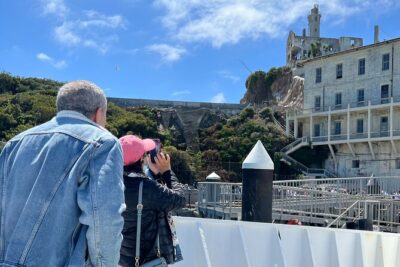
Alcatraz Inside Access Ferry and Audio Tour with Night Option
Read our review →

Golden Gate Bridge to Sausalito Self-Guided Bike Tour
Read our review →Browse the lists this tour appears in